Hiking in Southern Black Forest
Tracks
| Schluchtensteig: From Stühlingen to Blumberg | GPX | 21 km | 12/9 |
| Schluchtensteig: From Blumberg to Schattenmühle | GPX | 23 km | 13/13 |
| Schluchtensteig: From Schattenmühle to Schluchsee | GPX | 30 km | 16/13 |
| Schluchtensteig: From Schluchsee to Sankt Blasien | GPX | 22 km | 7/9 |
| Schluchtensteig: From Sankt Blasien to Todtmoos | GPX | 22 km | 10/9 |
| Schluchtensteig: From Todtmoos to Wehr | GPX | 26 km | 16/20 |
| From Münstertal-Mulden to Kälbelescheuer | GPX | 12 km | 13/7 |
| From Hausach to Hornberg | GPX | 21 km | 14/13 |
| From Hornberg to Triberg | GPX | 19 km | 14/12 |
| From Titisee to Lenzkirch | GPX | 11 km | 4/5 |
| From Hinterzarten to the Feldberg | GPX | 15 km | 9/5 |
Descriptions
Schluchtensteig
The "Schluchtensteig" ("Steep Track along Canyons") is a six-day official hiking trail along the canyons of rivers Wutach and Wehra. You can find lots of information on the web. Therefore I'll only shortly describe the six days here. The official site of the Schluchtensteig is available only in German. An English summary can be found here. Surely all six legs are among the best hiking routes you can find in Germany, though they are quite diverse.
From Stühlingen to Blumberg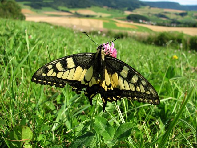
This is the first leg of the "Schluchtensteig".
Clear view: 4/5
Nature: 4/5
Culture: 3/5
From Blumberg to Schattenmühle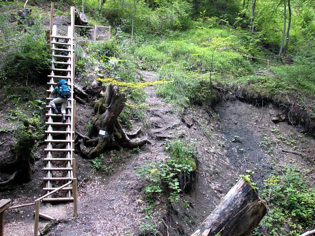
This is the second leg of the "Schluchtensteig".
Clear view: 3/5
Nature: 5/5
Culture: 2/5
From Schattenmühle to Schluchsee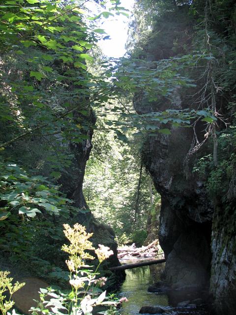
This is the third leg of the "Schluchtensteig". Officially it ends earlier in Oberfischbach. We've added a few km to stay over night at the main village of the lake.
Clear view: 5/5
Nature: 5/5
Culture: 4/5
From Schluchsee to Sankt Blasien
This is the fourth leg of the "Schluchtensteig".
Clear view: 3/5
Nature: 4/5
Culture: 5/5
From Sankt Blasien to Todtmoos
This is the fifth leg of the "Schluchtensteig".
Clear view: 5/5
Nature: 4/5
Culture: 3/5
From Todtmoos to Wehr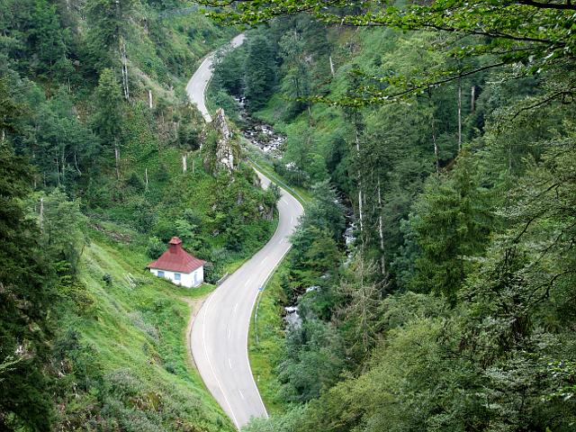
This is the sixth leg of the "Schluchtensteig".
Clear view: 5/5
Nature: 3/5
Culture: 3/5
From Münstertal-Mulden to Kälbelescheuer
This trail winds through the heights of 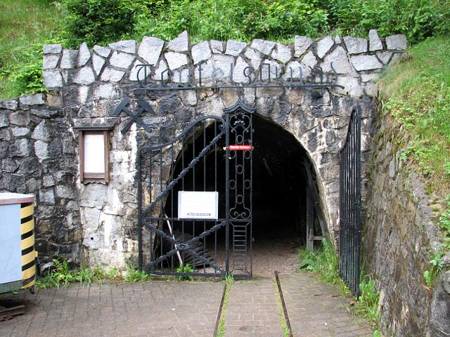 Southern Black Forest. Almost at the beginning it passes the historic silver mine "Teufelsmine" ("Devil's Mine"). The destination Kälbelescheuer is famous in the region.
Clear view: 5/5
Nature: 3/5
Culture: 4/5
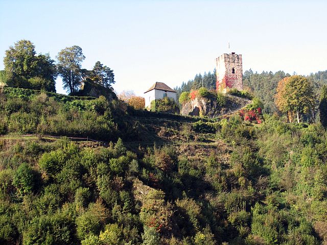
From Hausach to Hornberg
This is the center of the Black Forest. Yet it  is not a remote and lonely area, as the Black Forest Rail leads through it. For this reason it's possible to get here from Karlsruhe by train in just a little bit more than an hour, without having to change. This track is the seventh leg of the Westweg and it is considered to be one of the toughest. This is partly due to the track leading more or less on a ridge over a number of peaks of which some exhibit a rare, even strange, shape. The track runs parallel to the valley of the Gutach and therefore parallel to the tracks of the railway. The railway itself can only be seen shortly before t
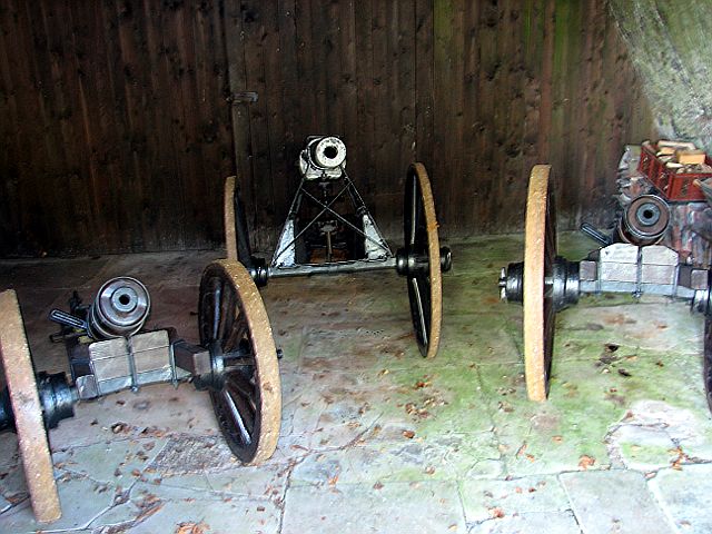 he end of the trip at Hornberg. From the castle above the town one can not only see a viaduct of the railway as the dominating construction of the town, but also three canons. Hornberg is proverbial in Germany for the result of its "Schießen" (shooting). If one would follow the railway tracks eastbound after a few kilometers they'd appear to have lost orientation, as they wind four times. When the Black Forest Rail was built this way, it was the first time a railway used this idea to reduce an else difficult grade. The same engineer - Robert Gerwig - suggested the principle again for the Gotthard railway.
Clear View: 4/5
Nature: 4/5
Culture: 4/5
From Hornberg to Triberg
 We walk out of Hornberg opposite of the castle looking down on the village and an, uhm, odd sculpture. Slowly, but ever ascending the first half is mostly within the forest until by and by there are more occasions of views over the landscape – with a special mention of the Großvaterstuhl – until around mid-track there are so many small summits hat one ends to omit some. We take a late lunch in Gremmelsbach and continue afterwards with the last third of the track where the Drei-Bahnen-Blick awaits, a
 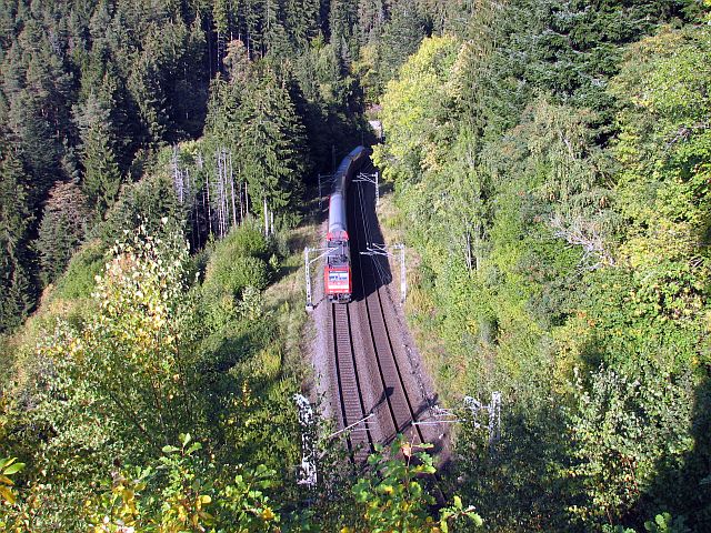 position from where one can see three seemingly about parallel railway tracks. Three tracks? Here in the remote Black Forest? In fact it is only one. The Badische Schwarzwaldbahn in this region proceeds not straight forward, but in slings to gain elevation and limit the incline. The Schwarzwaldbahn was one of the fields of activity (others being the Berlin Reichstag and the Gotthard rail) and maybe the opus magnum of the as restless as ingenious engineer Robert Gerwig. The railway line's incline is limited to about 1.6% and in this
  manner passes Black Forest peaking at 825 meter. From the Drei-Bahnen-Blick it is only a short way down to Triberg where there are some well known waterfalls. However as they are some km to the other end of the village and as the track was although not very long still not the easiest one, we postpone a visit to a later return to Triberg.
Clear view: 4/5
Nature: 3/5
Culture: 4/5
From Titisee to Lenzkirch
The start of this tour is at the station of  Titisee. Twice an hour a train comes here from Freiburg's main station through the Höllental (hell's valley) – watch out for the deer monument along the rails. In 35 minutes the train climbs from 280 to 890 meters through the very narrow valley. At the station where we leave the landscape is wider with mountains ranging up to 600 meters higher than the „valleys“. We leave the station towards and through the Hochfirststraße which is named after the mountain which we plan to cross today. We pass the Gutach creek, which is the effluent of the Titisee and which is one of the two sources of the Wutach (see the Schluchtensteig tracks above). For a few meters the track leads along the lake and along the Westweg. Then we need to keep left and underpass the rails of the Dreiseenbahn. From here it is 3 km far and 300 up to the top of Hochfirst. About half-way we pass the edge of the village of Saig. Shortly beneath the top of the Hochfirst there is a great view down over the Titisee. Normally also the Feldberg can be easily seen from here, but we had bad luck with the weather on that day. From the summit of the Hochfirst on we follow the Mittelweg. The Hochfirst is elongated in South-Eastern direction and the track follows the crest. A hut marks the crossing where the way to Kappel and the Rechenfels at the confluence of Gutach and Haslach departs. It would be an interesting tour to go there and then to Neustadt, but as the day ends early on such a winter's day we descend to Lenzkirch. At the main bus station of Lenzkirch the Mittelweg crosses the Schluchtensteig. Waiting for the bus offers a good chance to taste a Schwarzwälderkirschtorte in one of the Cafes of the village. The bus runs back to Titisee within about half an hour.
Clear view: 4/5
Nature: 4/5
Culture: 3/5
From Hinterzarten to the Feldberg
This tour leads through the heart-core of Black 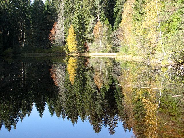 Forest on to its roof, the Feldberg. The starting point Hinterzarten can be reached from Freiburg with the famous Höllentäler, a rail line through the narrow Höllental (Hell's Valley). In former times, before man started to equip the Höllental with traffic infrastructure the valley at its narrowest point was just nine meters wide. It is said that once a deer managed to escape his chasers by jumping from one side to the other. To prevent this from happening once more man has placed another deer at exactly that position. First it was a wooden deer, because wooden dears can jump much less well than their fellows of flesh and bone. This, however, still appeared not safe enough, so it was replaced by a deer of bronze, because dears of bronze have even more difficulties to move than their fellows of wood. This scheme proofed to be successful as at an inspection
 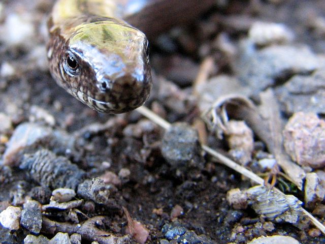 some time later 35 bullet holes were counted, which shows that by widening the valley and replacing the deer with a more hunter-friendly implementation man managed to allow modern hunters to be much more successful than their pitiable medieval precursor. So watch out for the deer (but don't shoot at it). A little higher in the valley the train passes the Ravenna Canyon the major obstacle for the railway to be crossed. The bridge over the canyon at the time of its construction was a masterpiece in railway engineering. The hiking tour itself leads out of Hinterzarten and soon into the forest. It rises moderately. It takes less than an hour to reach the Mathislesweiher, a small lake, usually quiet enough to make a good mirror for the hills on the remote side. About half an hour later, the path passes close (don't miss it, it is a few steps next to the trail) to a graded glade which opens toward the Feldberg. The view is great, but it also shows that between us and
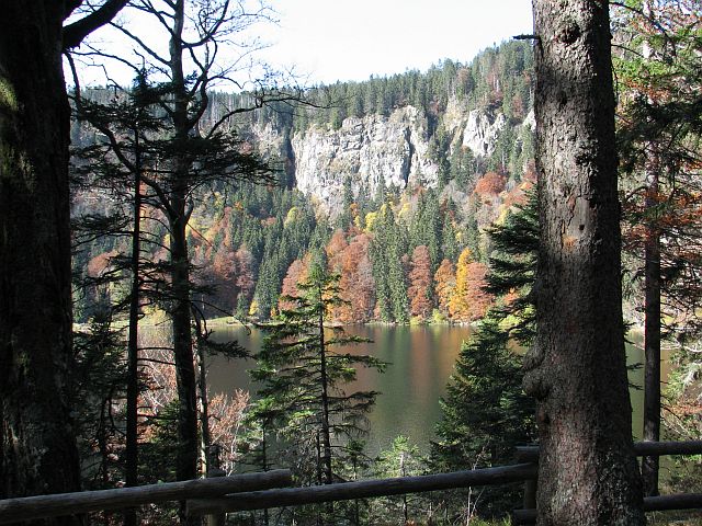 the Feldberg, a valley lies which implies more altitude to be made than one might have thought so far. Consequently we first have to go down, first along a street, but don't worry this is not for long. Later we are back into a forest which in autumn is not black at all, but pretty colorful. Follow the signs toward the Feldsee and you will soon see the Raimartihof a restaurant, which – given acceptable weather – is crowded and lively. About five minutes from the Raimartihof we stand at the shore of the Feldsee and at latest now it is obvious, why so far the terrain has been rather flat and easy although the Feldberg: much of the rise is still ahead of us. On the about one km to Feldberger Hof it is 170 m to climb on a varied path. From there a cableway can take you 140 more meters higher on top of the stretched top plateau of the Feldberg. To the actual summit
 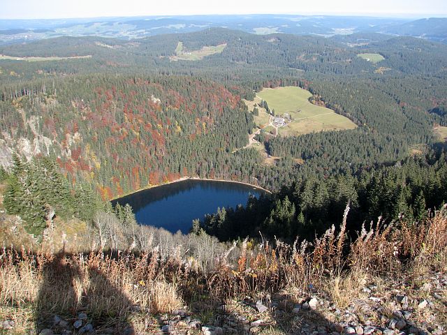 it is still two km to go. However already near the top station of the cableway one has a good view into all directions, down to the Feldsee, back over today's trail, to the north over the ranges of Black Forest, to the west toward the Vosges and to the south – provided weather conditions permit – to the Alpes, including Eiger, Mönch, and Jungfrau. To get back home one can either walk down to the rail station of Bärental or take the bus to Titisee. Judged at the standard of what we have done so far today the walking path to Bärental is rather unspectacular, so one can just take the bus and spend some time at/in Titisee instead.
Clear view: 5/5
Nature: 4/5
Culture: 3/5